-
-
May 8, 2024 at 5:51 pm
Matthew Little
SubscriberIn Mechanical, I created a coordinate system (csysLocal) to create construction paths. Is there a way to take End1 of a path (which is based on csysLocal) and determine what those coordinates are based on the global coordinates? I am looking to do this via a script as this will need to be automated.
-
May 10, 2024 at 11:43 pm
mjmiddle
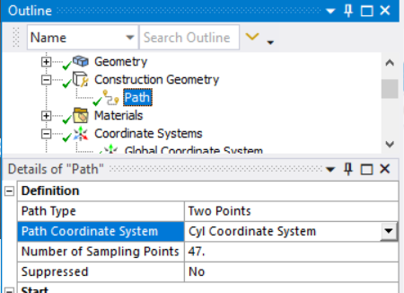
Ansys EmployeeHave you defined a local coordinate system on a path definition?
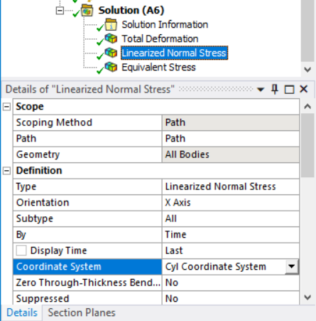
Or on a linearized result?
Are you just trying to get one point (first point) in the global coordinates, or all the locations along the path in a result?
If you export the data from a result scoped to a path, the XYZ will be in global coordinates. This export command could be done by script.
-
Viewing 1 reply thread
- The topic ‘Convert Local Coordinate to Global – Automated’ is closed to new replies.
Ansys Innovation Space


Trending discussions


Top Contributors


-
3492
-
1057
-
1051
-
965
-
942
Top Rated Tags


© 2025 Copyright ANSYS, Inc. All rights reserved.
Ansys does not support the usage of unauthorized Ansys software. Please visit www.ansys.com to obtain an official distribution.


